
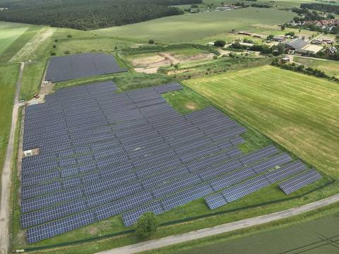
Drainage assessment for ground‑mounted solar farms
We show whether and how a planned installation changes the precipitation-runoff behaviour of the site and the flood risk in the surrounding area – as a basis for the permitting procedure.
Background
In the permitting procedure for a ground-mounted PV installation, the authorities also examine the risks from heavy rainfall and flooding. Depending on the region and the authority, a drainage assessment is required for this purpose.
The assessment describes the precipitation-runoff behaviour of the project site before construction and compares it with the changes caused by building the installation.
In general, building a PV installation does not adversely affect the precipitation-runoff behaviour of a site. Where the assessment shows a need for action, we describe measures.
Contents of the assessment
- Description of the precipitation-runoff behaviour of the site before and after construction
- Assessment of the effect on the flood risk in the surrounding area
- Scope as required: from the basic version to hydrodynamic modelling
- Where necessary: measures that fit into the design with minimal changes
- Report in German or English
Types of assessment
The scope depends on the questions to be answered in the permitting procedure.
| Basic version | Project-specific questions | Hydrodynamic analysis | |
|---|---|---|---|
| Purpose | brief review of the stormwater runoff situation | answers to specific questions, for example from public participation | detailed comparison of water flows after a heavy rainfall event |
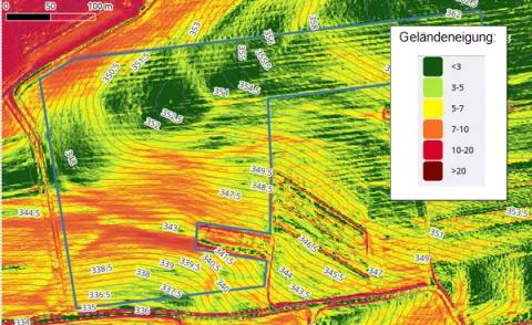
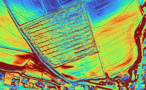
| Method | literature review, terrain assessment, research into the spatial context | depending on the question: GIS-based flow path and sink analyses, delineation of catchment areas | hydrodynamic model of the project site |
| Runoff simulation | no | depending on the case | yes, water depths and runoff over time |
| Application | standard case | for individual questions in the procedure | only necessary for special sites |
Basic version
Brief review covering the following points:
- Literature review on the effect of PV installations on stormwater runoff from open land
- Assessment of the installation site: overall impression and, where applicable, critical zones
- Research into the spatial context of the site, such as precipitation amounts
- General recommendations for improving the runoff situation
Project-specific questions
In the permitting procedure, for example during public participation, very specific questions often arise, such as: “Will the flood risk at my house downstream increase?” The method depends on the question.
Hydrodynamic analysis
Where required, we create a hydrodynamic model of the project site together with the hydrology department of the University of Kassel. A grid resolution of 1 m and a time step of 1 minute are usual. The results provide greater certainty when assessing the precipitation-runoff behaviour.
Measures
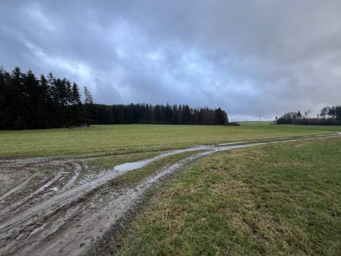
If the assessment shows that runoff changes adversely or that areas of the site are critical, we propose measures that can be implemented with minimal changes to the project. The basic version contains general recommendations for improving the runoff situation; the hydrodynamic analysis provides the basis for designing specific water retention measures.
Further assessments for the permitting procedure
Glare assessment
Glare effects on traffic routes and residents, determined by simulation.
Noise assessment
Noise immission predictions according to TA Lärm (German Technical Instructions on Noise Abatement) for battery storage systems, inverters and transformers.
RPS analysis
Distances of module tables, stations and fence to federal trunk roads according to RPS 2009 (German guidelines for passive protection on roads by vehicle restraint systems).
Landscape impact assessment
Visibility of the installation and assessment of its effect on the landscape.
Frequently asked questions
When is a drainage assessment required for a PV installation?
That depends on the region and the responsible authority. If the authority examines the risks from heavy rainfall and flooding in the permitting procedure for a ground-mounted PV installation, it often requires a drainage assessment.
Does a ground-mounted PV installation worsen surface water runoff?
In general, building a PV installation does not adversely affect the precipitation-runoff behaviour of a site. The assessment checks this for the specific site and, where necessary, specifies measures.
Which type of assessment do I need?
For most sites the basic version, a brief review without simulation, is sufficient. A hydrodynamic analysis is only necessary for special sites. We answer specific questions from the permitting procedure on a project-specific basis.
Does the basic version include a runoff simulation?
No. The basic version comprises a literature review, an assessment of the terrain, research into the site's spatial context (such as precipitation amounts) and general recommendations. Only the hydrodynamic analysis includes a simulation of the runoff.
Can you respond to objections raised during public participation?
Yes. We answer questions such as “Will the flood risk at my house downstream increase?” case by case, often with GIS-based flow path and sink analyses and the delineation of catchment areas.
Is the assessment also available in English?
Yes, we prepare drainage assessments in German or English.
How long does a drainage assessment take?
Usually two to three weeks after receipt of complete documents. If it is urgent, please contact us.
Enquiry
Use the form, call us on +49 4103 121 4221 or write to kontakt@sonnwinn.de – whichever suits you best.
You do not need to attach documents to your enquiry – once we have received it, we will help you put together the documents required.
Which documents are helpful
- Site plan or layout plan of the installation with the plan boundary, tracks, fence and stations, preferably as DWG, shapefile or KML
- If available: soil survey, development plan and comments from the water authority